The Siding Of
Lacy
| West to Dos |
The Siding Gallery, by design, does not show any trains (unless it is unavoidable) in pictures of the sidings. This is so you can see the layout of the land and get your own ideas on how to take pictures of trains. However, if you'd like to see pictures taken from various spots at this siding, then you can Search the Photo Gallery for pictures here on ColoradoRailfan.com!
The Siding of Lacy is located at milepost 390.1 and is one of the newersidings on the journey from Denver to Salt Lake City. In 1977, Lacy had not yet beenbuilt, so there was no siding for the 12.5 miles from Rifle to Dos (heading westbound).Today, however, Lacy is 3.5 miles west of Rifle and is a descent length siding at7,050 feet.
Lacy is accessible at the east end by taking the West Rifle exit off of Interstate70. Turn south under the bridge and proceed down a dirt road. Often times fishermanuse this road to get to the Colorado River on the south side of the tracks. The west endis accessible by following the I-70 frontage road. There is a turnoff heading souththat takes you to a public grade crossing roughly 1,000 feet from the west switch ofthe siding.
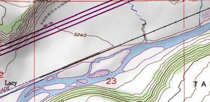
Here is the topographical representation of the area of Lacy. This particular mapdoes not very clearly define the siding, but it is on the north side of the mainline.Note I-70 and it's frontage road (three purple lines) running along the top of the map.

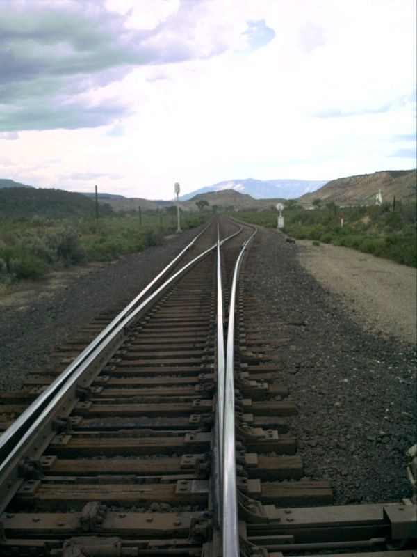
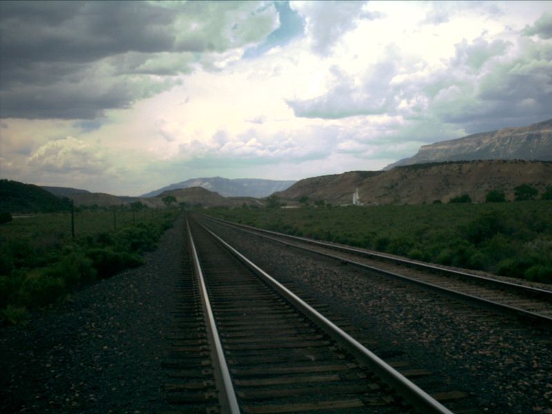
Picture 1
Here is a picture of the west end of Lacy, looking [track wise] east. Union Pacifichas been laying some of their own [granite] ballast in the area lately, and the classicRio Grande scoria is not nearly as common as it once was. Through this particularstretch of track, the speed limit for freight trains is 60 MPH and a rather swift 79MPH for passenger trains!
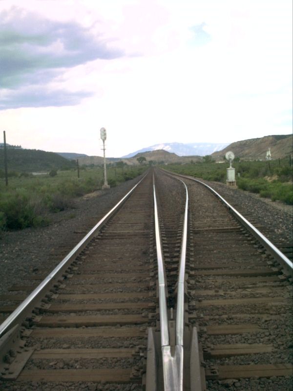
Picture 2
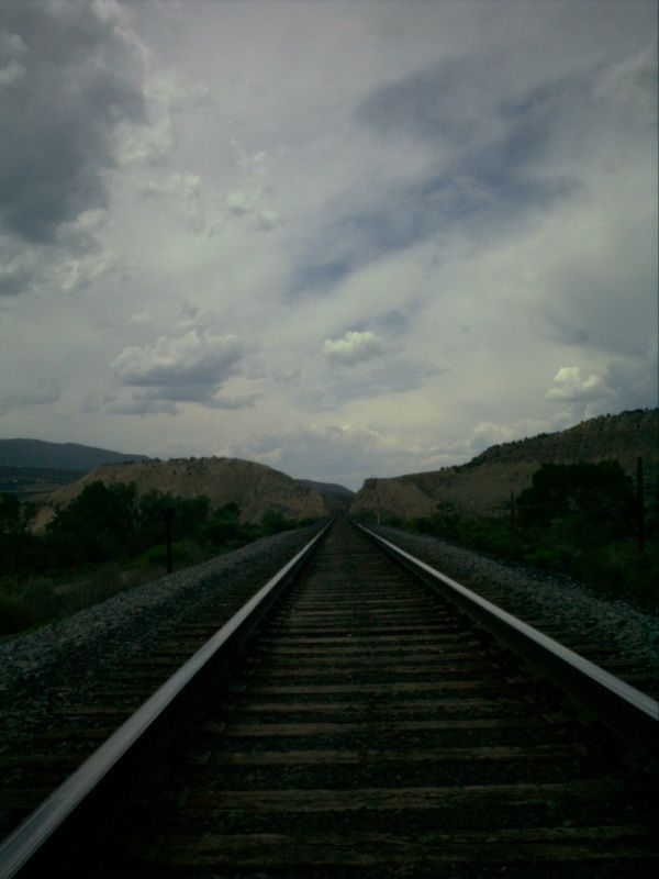
This picture was taken from roughly the same spot as the above picture, but thiswe are looking [track wise] west. The grade used to curve around to the left, aroundthe rather large hill in the way. However, a cut has been created to allow for aslightly more direct route to points west.
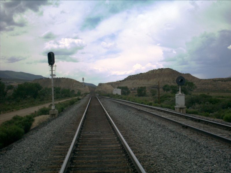
Picture 3
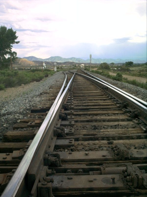
Notice how the points of the switch at the west end of Lacy are relatively longand very stable looking. This is to make sure those 79 MPH passenger trains runsafely through the switch!
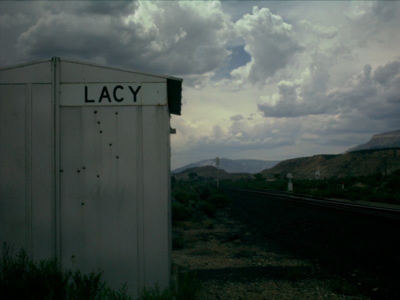
Picture 4
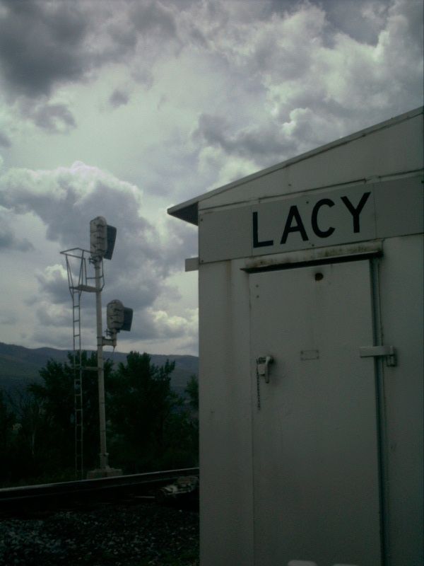
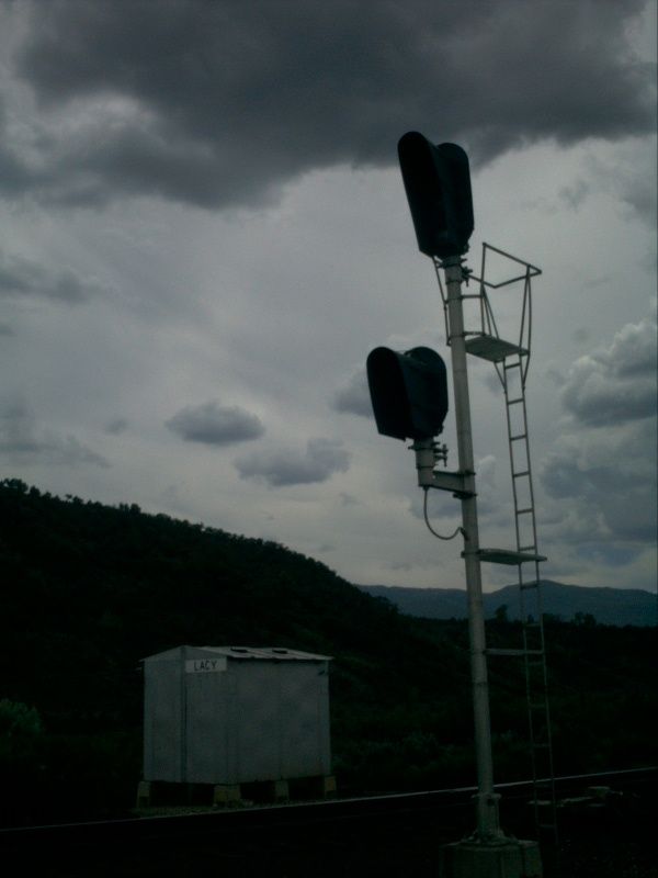
Unlike many of the silver control boxes on the Rio Grande system, Lacy does nothave the name painted onto the box itself. Instead, a sign with the name Lacy hasbeen attached to the box. Union Pacific is now replacing these signs with ones that,in addition to just having the name of the siding, the exact milepost of the switchwill be included.
Picture 5
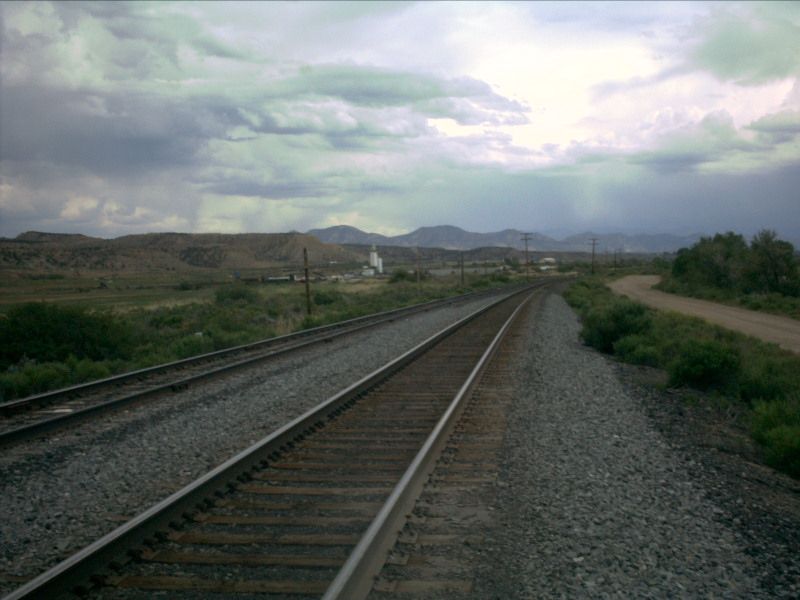
After going around the first curve to the right (heading eastbound), the trackshave a very straight shot the through the rest of the siding. Here is a look at thecurve at the west end. The lighting was not exactly the most cooperative on thisday in May 2001, but the clouds do look rather cool.
Picture 6
This picture is very similar to Picture 2 above. It puts the siding intoperspective with the cut located to the west of the siding.
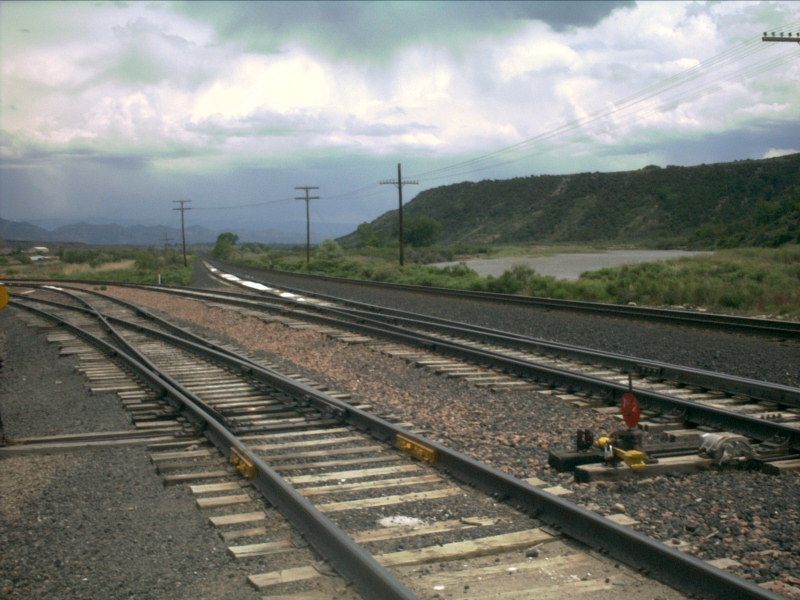
The west end of Lacy is also the location of a fairly substantial sizedindustry. There are two switches off of the siding near the west end to service theindustry. Although I'm not sure what the industry produces, covered hopper cars arewhat you will primarily find here. There are also some rather conspicuous pilesof talc lying in the tracks in several places!

Picture 7
This is the second of the two switches (when heading east). Note the tracks fromthe first switch off to the left of the picture. Some of those conspicuous talc pilesare also located in the siding a little past the switch. It is again somewhatinteresting how secure the left point of this switch looks.

Picture 8
Here is a shot more at tracklevel, showing more of the leads to the industry.Three hoppers sit ominously on the far left lead, most likely either waiting to betaken away by the next local that comes through.

Picture 9
Here is the first of the two switches leaving the siding heading into theindustry. Again, the cut in the background makes for a good reference point, allowingyou to get a good idea as to where the industry leads are located.
Picture 10
Another shot similar to Pictures 7 and 8. In this picture, you can see theColorado River in the background, flowing toward the Gulf of California. This picturealso demonstrates how straight Lacy is once you get around that initial bend.
Picture 11
Many substantial piles of talc are seen lying in the middle of the siding. Seemslike they would be found more on the industry leads, but on this particular day,the siding had more piles than any of the leads!
Accessing the middle of Lacy isn't very practical. So, we move down to theeast end. From the east end, even without a super powerful telephoto lens, there isa noticeable change a grade. Every siding has at least some degree in change, but itis always more noticeable on the long, straight stretches of track.
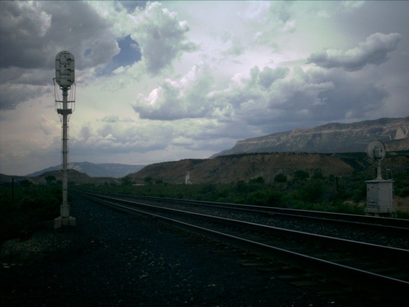
Picture 12
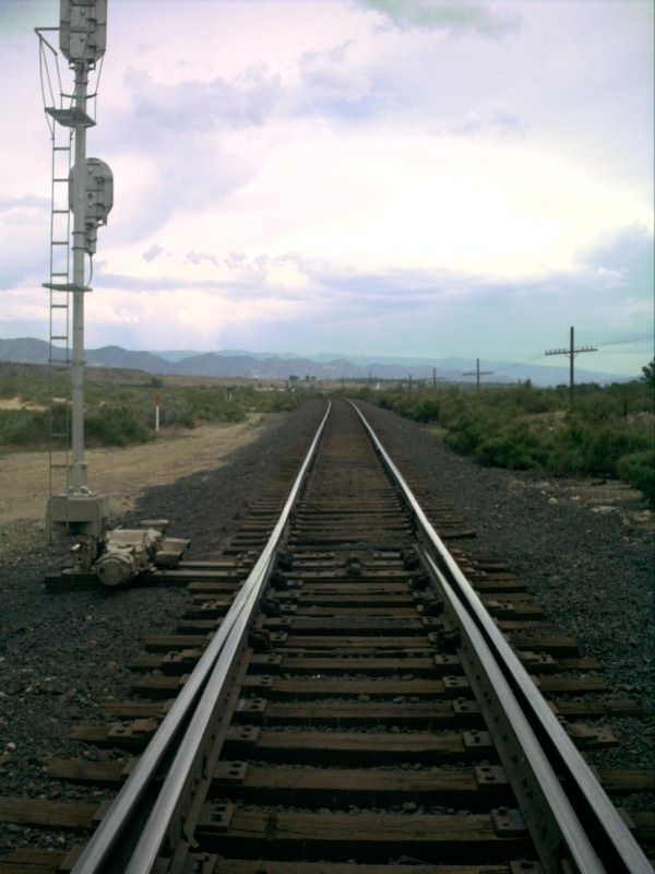
Looking to the west down the points of the east switch of Lacy, You can see thechange in grade particularly in the siding, but if you look closely, it is noticeablein the mainline as well. Once again, there are relatively long points at the eastswitch to support the high speed trains.
Picture 13
Unfortunately, railroad property is often the target of vandalism of one typeor another. Cars are usually subject to graffiti, and signs and boxes are oftensubject to target practice. The control box at the east end of Lacy is no exception,showing some scars from rifle shots. (Ironically enough, this side of the controlbox faces the town of Rifle).
Picture 14
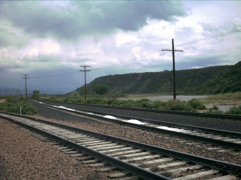
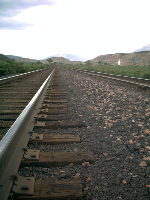
The east end of Lacy has not yet been the target of new ballast from UnionPacific. The classic Rio Grande scoria is still the dominate type of ballast here.In the distance, you can see the [dirt] hill which the cut west of Lacy runs through.
Picture 15
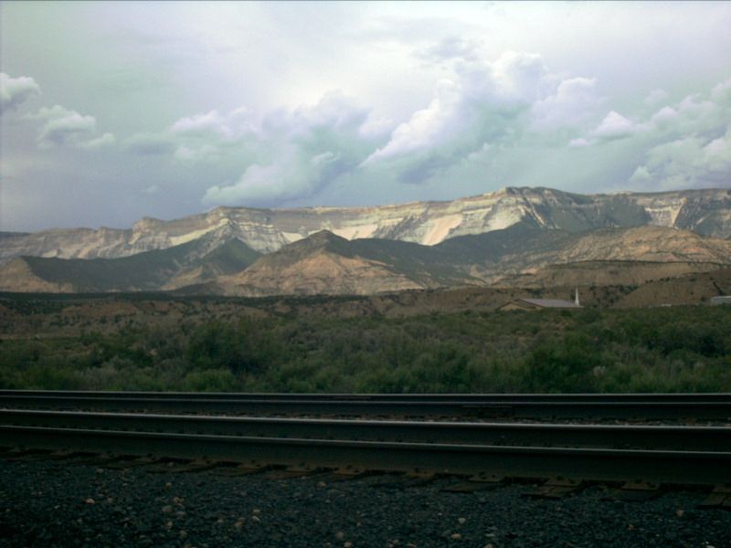
Another picture where the tracks are not in the best of lighting, but I leftthe picture in the set because I like the look of the clouds floating innocently inthe sky. Being a little ways west of the Continental Divide, the mountains startto take on more of a plateau look that is common in the Grand Junction area.
Picture 16
Not a whole lot to say about this picture. It just does a good job of describingwithout words the area of Lacy. One thing worth noting is the white building stickingup toward the right of the picture. This is the main building for the industry atthe west end of Lacy.
Picture 17
Once again, another picture that is really worth a thousand words...
Picture 18
This picture is looking to the east, towards the town of Rifle. Note the mountainsin the background are more like the 14,000 foot mountains found along the divide asapposed to the plateau-type mountains found directly along Lacy and out towards GrandJunction.
Picture 19
The track on the right of the picture is the siding and the track on the left sideis the mainline. Generally speaking, mainline track is welded rail (meaning a singlepiece of rail goes for several hundred feet without a joint) whereas sidings tend tobe jointed rail. Lacy is no exception to this rule. There is no joint in sight alongthe mainline, but joints are frequent and regular on the siding.
Picture 20
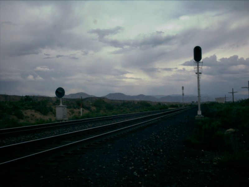
Although the lighting, again, is terrible for trains in this picture, I did likethe silhouette affect of the block signal on the clouds in the background...
Picture 21
We close out Lacy looking, once again, to the east toward Rifle. It is a shortdistance (only 3.5 miles) to Rifle from Lacy. The tracks curve to the left as seen inthis picture and run underneath I-70. They then curve around to the right and wind uprunning right through Rifle.
LACY STATISTICS
EAST SIGNALS
WEST SIGNALS
Date Added: 5/28/2001
Subdivision.. Glenwood Springs
Milepost..... 390.1
Length....... 7,050 feet
Speed........ 79-60
Dispatcher... DS-80
AAR.......... 23 (160.455)
House Track.. None
Branches..... Two Industrial Leads
Grade Xing... One private crossing (Dirt Road)
Access Road.. None
Westbound......... Approach Lit
Eastbound Main.... Approach Lit
Eastbound Siding.. Approach Lit
Eastbound......... Approach Lit
Westbound Main.... Approach Lit
Westbound Siding.. Approach Lit
Last Data Update:
Last Picture Update:
|
|
Check out ColoradoRailfan.com on Facebook |
|
|
Check out the latest ColoradoRailfan.com photos on Flickr |
|
|
|
||||||